SOCIAL ZORBING
New Multilayer Public Space Paradigm

Social Zorbing. New Multilayer Public Space Paradigm. The purpose of this project is to identify people's behavior and post lockdown trends in 4 different countries: Ecuador, Thailand, Croatia and Russia. These 4 countries followed different lockdown duration and rules. The hypothesis is that the number of Covid cases influenced people's attitude toward public spaces and social relationships in space and time.
Today, after we all understood the necessity of being separated by walls and distance, we tried to find a way to adapt to the new social reality. However, we should take into account not only people's behavior but also the design of our cities. In order to become more responsible we have to make our cities responsive.

Our project considers COVID-19 lockdown situation in 4 cities: Quito (Ecuador), Ufa (Russia), Zagreb (Croatia), Phuket (Thailand). These cities experienced quarantine in a different way and time. Though, all are exposed to similar rules now. Limited movements, partial working hours and the most popular - social distancing is a new way of life.
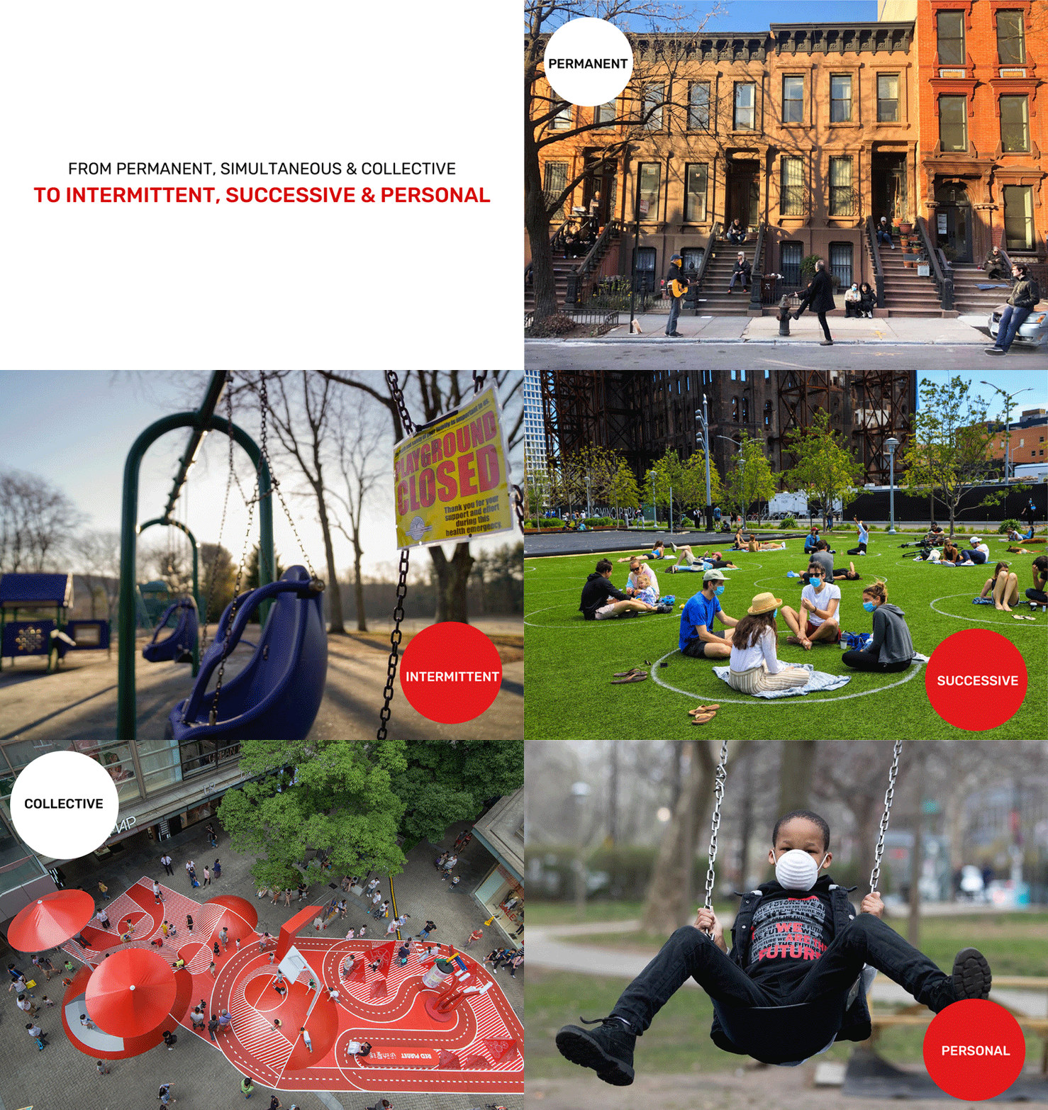
Concept: New urban space paradigm: From Permanent, Simultaneous & Collective to Intermittent, Successive & Personal.

Under all these circumstances, our duty as designers is to find solutions to make cities safe and adjustable. Three parameters were chosen to achieve the target. Firstly, we have to think about temporal aspect as it influences our schedule and forces us to gather together (pich hours). The second one is spatial. Social distancing requires more space to use. Finally, people are used to being in close contact with each other, so the social aspect has to be reviewed. Here we are going to focus on spatial parameter and try to propose some solutions for 4 cities mentioned above. Multilayer Public Space.

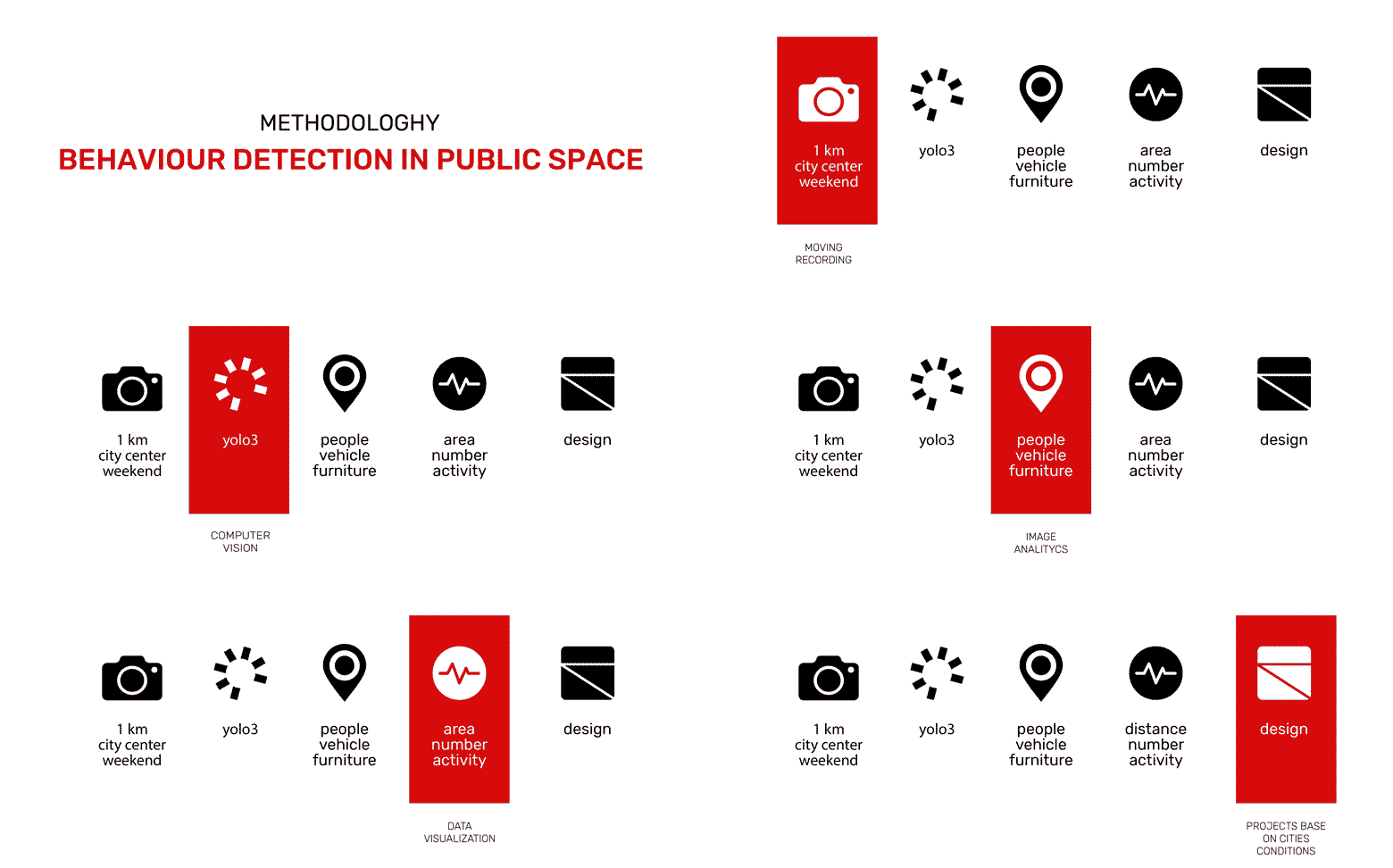
To better understand what is happening on streets after pandemy 1km walk was recorded in each city. These records were then proceeded with YOLO3 in order to detect objects that appear. All detected objects were categorized as: person, bicycle, vehicle, furniture. Number of objects from each category acknowledge us about the general situation in the city.
Video player
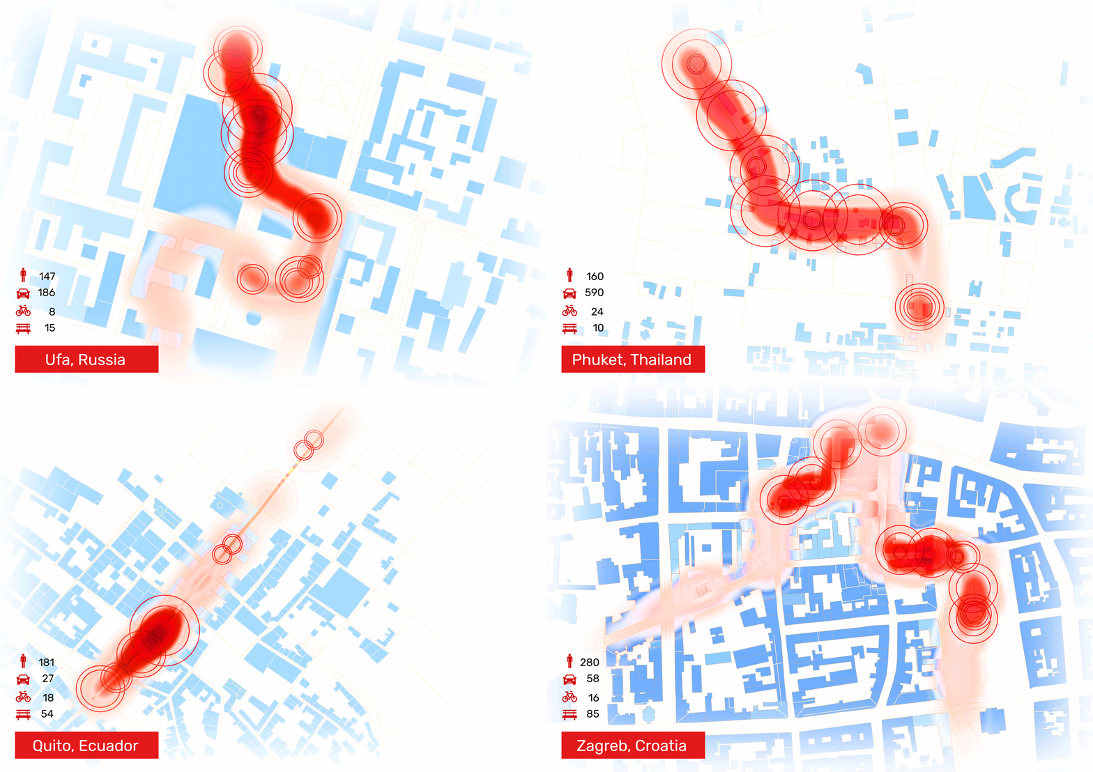
Heatmaps below show us concentration of people in each part of the path. We can see how close people are to each other and it is obvious that our streets don't allow us to keep a safe distance. By extracting the most busy site we calculated the area that we need.

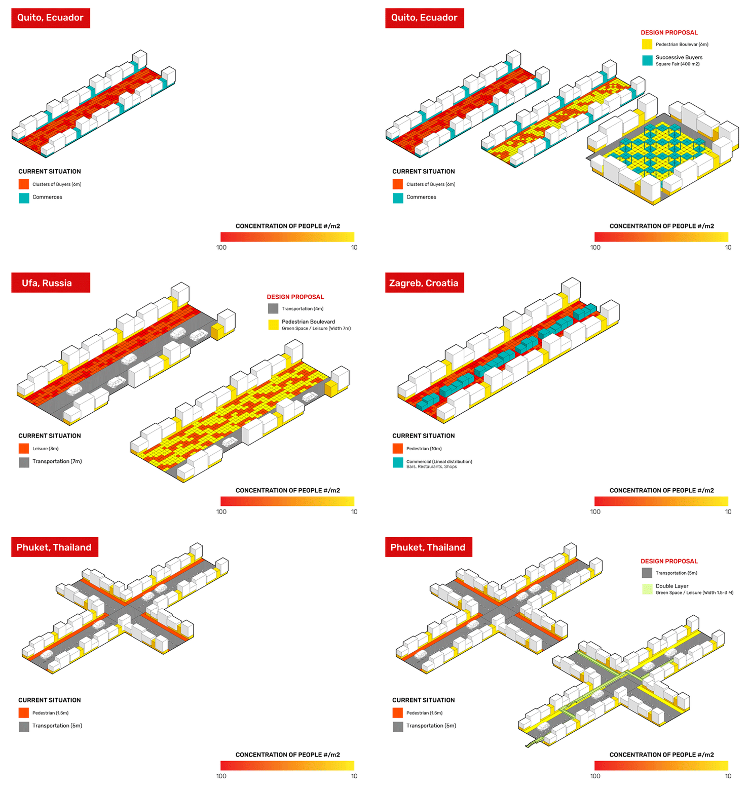
On the other hand we are interested not only in the number of “objects” but also in activities. The busiest site was divided into 3 main applications: commerce, transportation and leisure. These layers of city life should stay overlapped to provide city efficiency but at the same time flows of people have to be separated.

According to this we came up with different conceptual proposals for each city. The narrow sidewalk in Ufa makes people crowd on it. And those who wait at the bus stop prevent others from freely walking through. So, the transportation layer (road) is proposed to narrow down in order to give more space to the sidewalk.

Pedestrian Zagreb street accommodates many restaurants that are located very close to each other. Their position provokes people to walk very close to those who are eating. Patterns of street cafes should be revised. For this we propose to scatter them around the street and make more space for people to walk.
The culture of Thailand prioritizes movement by using vehicles, so their sidewalks are really narrow and actually nobody uses them. All activities happen in intersections and terraces. The proposal here is more radical than in other cities. The second pedestrian layer can be added to lead people away from the road.
Street in Quito old center is fully occupied with commerce that forces people to stick around. Some of these could be moved to the big square next block and therefore disperse people in space. Commercial layer here gives more opportunities to transportation.

It is a project of IAAC, Institute of Advanced Architecture of Catalonia.
Master in City and Technology, MACT 2019-2020.
Students: Byron Cadena (MaCT), Linara Salikhova (MaCT),
Ines Kavar (MAA), Pawitra Bureerak (MaCT)
Faculty: Aldo Sollazzo, Soroush Garivani, Iacopo Neri.
Place: Barcelona, Spain
